
Journal / Methods & Concepts
UNCREWED LiDAR POWERLINE SURVEYS - An Alternative to Helicopter Flights?
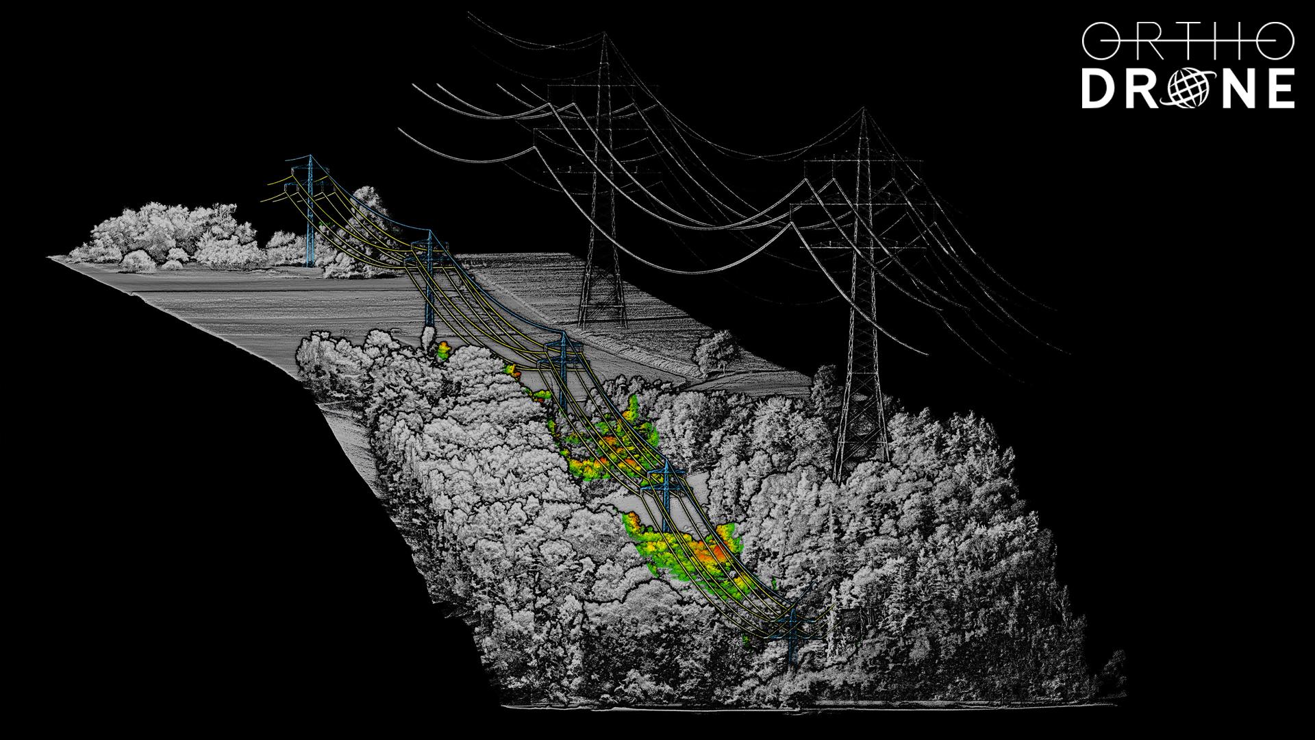
ULS Point cloud of transmission lines & encroachment visualisation
A faulty electrical transmission line in 2018 led to the deadliest and most destructive wildfire in California history. Worldwide, the inspection of powerlines is a major challenge for every power provider. However, uncrewed LiDAR powerline surveys can be a realistic inspection solution, providing consistent data and lowering risk for customers and personnel.
Diagnostic Innovation: Bringing Power to the People
Knowledge of potential threats to these proverbial veins of life is essential to ensuring the safe and efficient operation of electrical transmission systems. A three-dimensional view and reliable information on the conditions of powerlines, poles, and the surrounding vegetation and structures are key for improving risk management of this critical infrastructure.
Helicopter flights with cameras and LiDAR sensors have been the choice method for assessing these networks in the past. However, uncrewed LiDAR powerline surveys have become a serious and practical alternative to the expensive and resource-intensive use of helicopters. Even now, drone flights are logistically more flexible and cost-effective for small to moderate survey distances, and their speed and altitude versatility can lead to better detail and accuracy.
The Ups and Downs of Flight Planning for Difficult Terrain
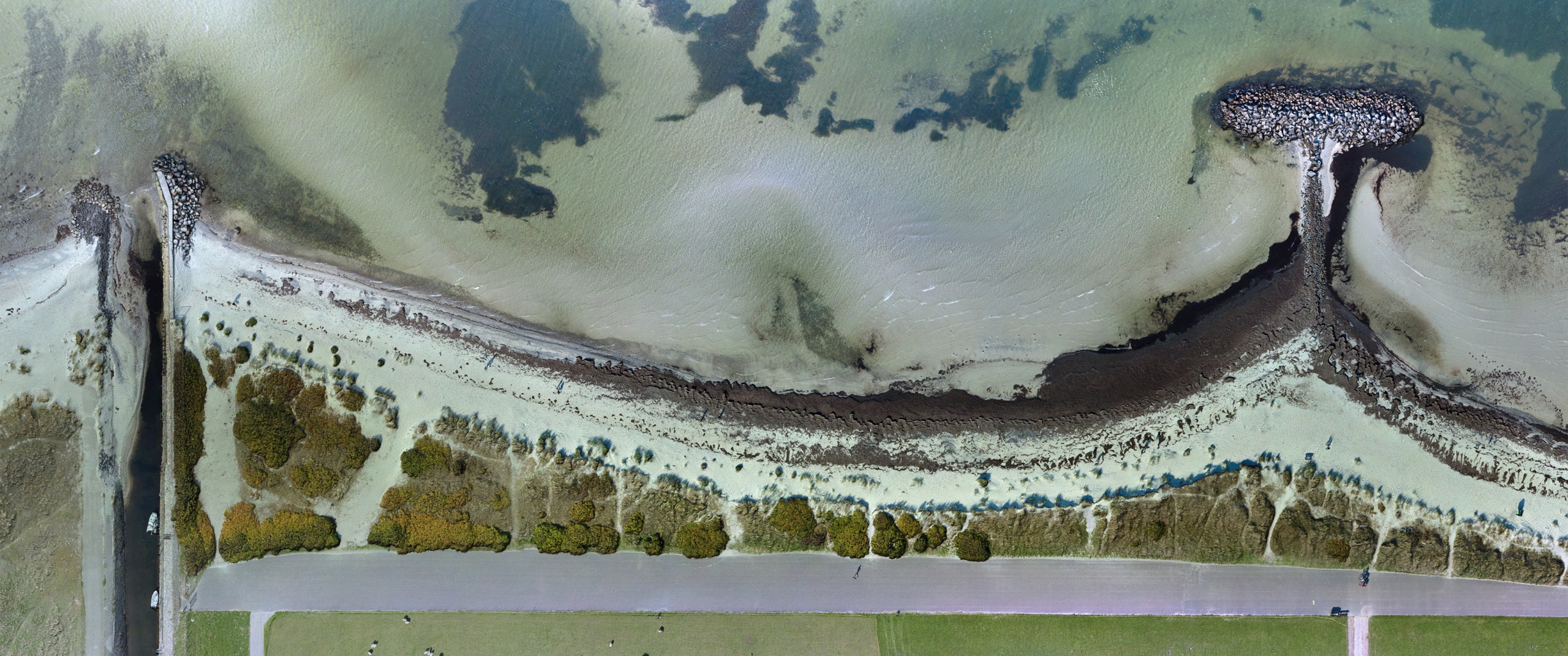
Gathering detailed, accurate LiDAR data is not a straightforward process, especially in areas with challenging topography. The German state of vineyards, Baden-Württemberg, contains many hills and valleys that need to be considered during flight planning. The proximity of the project area to railroads and highways meant adhering to much stricter flight and safety regulations. Direct communication with the local authorities about applicable legal restrictions before surveying was extremely important.
Since this mission was a pilot project for our client and because the areas to be scanned were relatively small, we chose a visual line-of-sight (VLOS) approach. Flying very close to this kind of infrastructure demands a high degree of precision and experience during any kind of uncrewed powerline survey.
What made this project particularly interesting, though, was the close proximity of several powerlines in one of the areas – and the fact that this particular line services one of Europe's largest theme parks. Having a highly skilled team on site is the cornerstone of our services. Data acquisition was conducted as planned (and no rollercoasters were stuck upside down).

ULS simplifies data acquisition for complex terrain and hazardous areas
Hybrid UAS: More Airtime for Survey-Grade Sensor Systems
Combining an experienced team with a highly capable uncrewed aerial system (UAS) is integral for uncrewed LiDAR surveys in a challenging environment. Our combination of a survey-grade uncrewed LiDAR system with a gas-hybrid drone allows for flight times of over two hours without landing. The hybrid UAS saves valuable time that would otherwise be spent on battery swaps and sensor recalibration.
This time-saving productivity is a core advantage of our services, as our hybrid LiDAR data acquisition is on average 35-40% more efficient than comparable battery-powered drones. As a result, we were able to acquire a high-resolution point cloud, with a particularly high point density on the powerlines themselves.
Crewed or Uncrewed Aerial LiDAR - That is the Question!
Accuracy, precision, and point density are some of the main aspects to consider when comparing helicopters to drones for aerial LiDAR powerline surveys. However, the length of the measurement corridor is also a factor when evaluating efficiency. Both methods can provide high-quality data.
While drones can fly much closer to the powerline, helicopters often carry heavier, more powerful sensors. Nonetheless, the areas of operation have begun to overlap, with current advances in uncrewed LiDAR technology leading to lighter and more powerful dual-use sensors.
uncrewed laser scanning (ULS) is more flexible concerning the viewing angle, as smaller size and greater manoeuvrability enable drone systems to fly at the same level of the line and mast. Helicopters, however, can fly hundreds of kilometres per day. While beyond visual line-of-sight (BVLOS) technology is available for current industrial UAS, legal restrictions and local permits are still a hurdle, albeit one that has becoming easier to tackle with the current changes and homologation in European drone legislation.
In short, uncrewed aerial LiDAR surveys make a lot of sense for small to medium range powerline sections, but currently helicopters are still able to provide a more practical option for capturing data over long distances. BVLOS operations have come of age, however, and hybrid multirotor systems allow for several hours of flight and hover time.
With the implementation of clear and actionable rules and permits, we expect to see hybrid ULS solutions replacing a good portion of current helicopter-based services in this field soon. Superior cost-efficiency and data quality, as well as higher modularity and more agile mission profiling, are sensible reasons to compel the transmission and distribution sector to implement a new and better concept of data acquisition.

ULS Point clouds allow for highly efficient in-depth vegetation analyses
Point Clouds: Asset Management at Your Fingertips
Uncrewed LiDAR point cloud data offer an array of possibilities for analyses that will enhance the safe and sound operation of power transmission and distribution systems. With Orthodrone, you can detect and identify encroaching vegetation and plan required maintenance. Our point clouds can also be used to examine conductor sag and determine where clearance heights are not being met. Most importantly, you can utilize the point cloud to inspect the condition of transmission system components, from tower top to base and everything in between.
Orthodrone also provides fully automated inspection flights, in cooperation with our partner SharperShape, to give full body overviews of whole powerline systems – allowing for a LiDAR model flight on one day and an automated visual inspection routine on the next. Combining survey-grade LiDAR data with our high-resolution metric camera payloads yields superior visual inspection data with up to sub-millimetre resolution. We are proud to offer our services to support the supervision and maintenance needs of those who work hard making sure our lights stay on. For a quick look at some (slightly decimated) datasets, open the links below in a desktop browser!
Survey I: River & Vineyard
Survey II: Forest Valley
Mobile Versions (experimental):
Survey I: River & Vineyard | Survey II: Forest Valley